


Eldridge City Hall, Walker County, Alabama
About
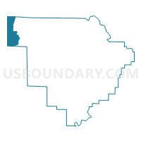
Outline

Summary
| Unique Area Identifier | 523056 |
| Name | Eldridge City Hall |
| County | Walker County |
| State | Alabama |
| Area (square miles) | 22.93 |
| Land Area (square miles) | 22.92 |
| Water Area (square miles) | 0.01 |
| % of Land Area | 99.95 |
| % of Water Area | 0.05 |
| Latitude of the Internal Point | 33.92639440 |
| Longtitude of the Internal Point | -87.61312750 |
Maps


Graphs
Select a template below for downloading or customizing gragh for Eldridge City Hall, Walker County, Alabama


Neighbors
Neighoring Voting District (by Name) Neighboring Voting District on the Map
- Baccus, Marion County, AL
- Browns, Fayette County, AL
- Carbon Hill Community Center Voting District, Walker County, AL
- Cole, Fayette County, AL
- Kansas City Hall, Walker County, AL
- Lynn Town Hall, Winston County, AL
- New Bethany Church Of God, Walker County, AL
- North River, Fayette County, AL
Top 10 Neighboring County Subdivision (by Population) Neighboring County Subdivision on the Map
- Winfield CCD, Marion County, AL (5,614)
- Carbon Hill CCD, Walker County, AL (3,581)
- Brilliant CCD, Marion County, AL (2,175)
- Lynn CCD, Winston County, AL (2,158)
- Northeast Fayette CCD, Fayette County, AL (1,469)
Top 10 Neighboring Place (by Population) Neighboring Place on the Map
Top 10 Neighboring Unified School District (by Population) Neighboring Unified School District on the Map
- Walker County School District, AL (52,671)
- Marion County School District, AL (24,873)
- Winston County School District, AL (16,345)
- Fayette County School District, AL (15,936)
- Winfield City School District, AL (6,698)
Top 10 Neighboring State Legislative District Lower Chamber (by Population) Neighboring State Legislative District Lower Chamber on the Map
- State House District 17, AL (42,595)
- State House District 16, AL (40,993)
- State House District 14, AL (40,597)
Top 10 Neighboring State Legislative District Upper Chamber (by Population) Neighboring State Legislative District Upper Chamber on the Map
Top 10 Neighboring 111th Congressional District (by Population) Neighboring 111th Congressional District on the Map
Top 10 Neighboring Census Tract (by Population) Neighboring Census Tract on the Map
- Census Tract 9647, Marion County, AL (5,614)
- Census Tract 211, Walker County, AL (3,581)
- Census Tract 9645, Marion County, AL (2,175)
- Census Tract 9659, Winston County, AL (2,158)
- Census Tract 200, Fayette County, AL (1,469)